


The trip to the cairn at Reinneset in one of the nicest most accessible family tours that we gladly offer. The short hike is packed with great nature experiences and joyful moments.
You will mostly walk on bare granite, and along the first part of the route, the paths winds between the scattered and small-grown mountain pines all around. The view becomes closer almost with every meter you walk, then eventually, you can look out over the whole of Skjomen and inward towards Sør-Skjomen.
To the west, you can enjoy the view of Reintind, Reintindbreen, whilst having Frostisen on the other side of the fjord. Walking on Reinneset evokes peace of mind, and a smile in mind!
- The first 700 meters are not marked, but you will clearly see where the trail is heading.
- Suitable for everyone, the last part can be a bit steep for small children
- Fantastic view of the Skjomen, the surrounding mountains and glaciers.
Please note that the maps are intended to give the starting point and approximate direction for the trip. They are not intended for precise positioning. You always have to make your own judgments when you are on a trip in the mountains based on what you see and think.
Practical information
Distance from the town of Narvik is about 45 minutes’ drive south of Narvik. Take the E6 at Skjomenbrua and follow the road to Skjomen.
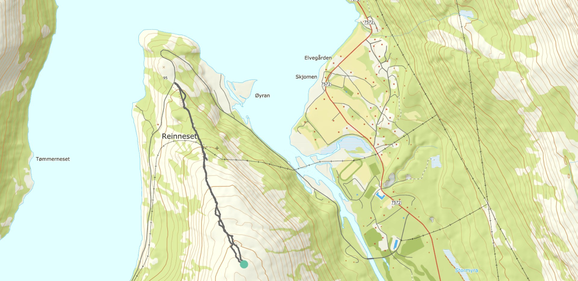
Getting there: Drive to Skjomen Golf Park and continue for 3.5 kilometres towards South Skjomen. When you are on at the top of the slope at Reinneset, you can park on the righ
When you are on at the top of the slope at Reinneset, you can park on the right side of the road.
You will find the path on the top of the road. The trail simply follows the ridge up the mountain.
The first 700 meters are not marked, but you will clearly see where the trail is heading. As you approach the radio mast and the power line, the path gets divided, you would have to stick to the right part of the path.
Eventually you will encounter cairns leading you upwards. The trip gives you 350 altitude meters in 2 kilometres, and if you are the person who likes to trigger high pulse, then just give it all you have!
The terrain is easy to work in. After a long continuous slope, the path flattens, and you find a small cairn with a post box like where you find a book that you can sign in for a successful trip!.t side of the road.
Duration: 30 min - 1 hour one way.
Hight: 350 meters
Length: 2 km
Medium – Blue grading
Suitable for:
Beginners and walkers of average fitness. For hikers with basic hiking and outdoor skills.
Type of path and terrain:
Similar to green trails, but can have more challenging sections. Can be rocky but no demanding scree. No streams to be crossed.
Altitude metres, maximum trip length:
Elevation difference: less than 600 metres. Max length: 10 km.
Degree of elevation and exposure:
Most ascents are moderate, but can include some steep slopes. Certain sections can be considered precipitous for some.
Inspiration
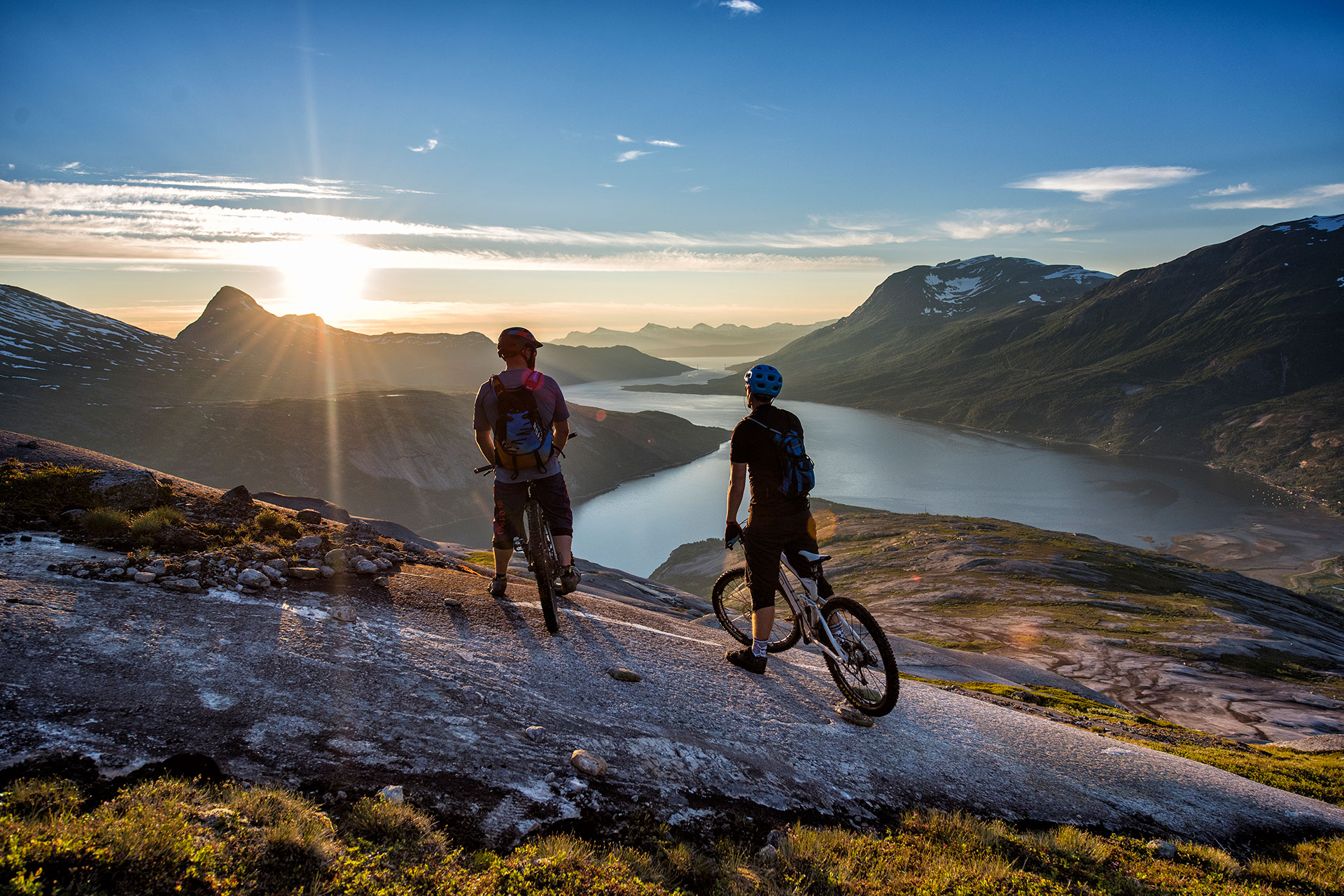
Photo: Rune Dahl
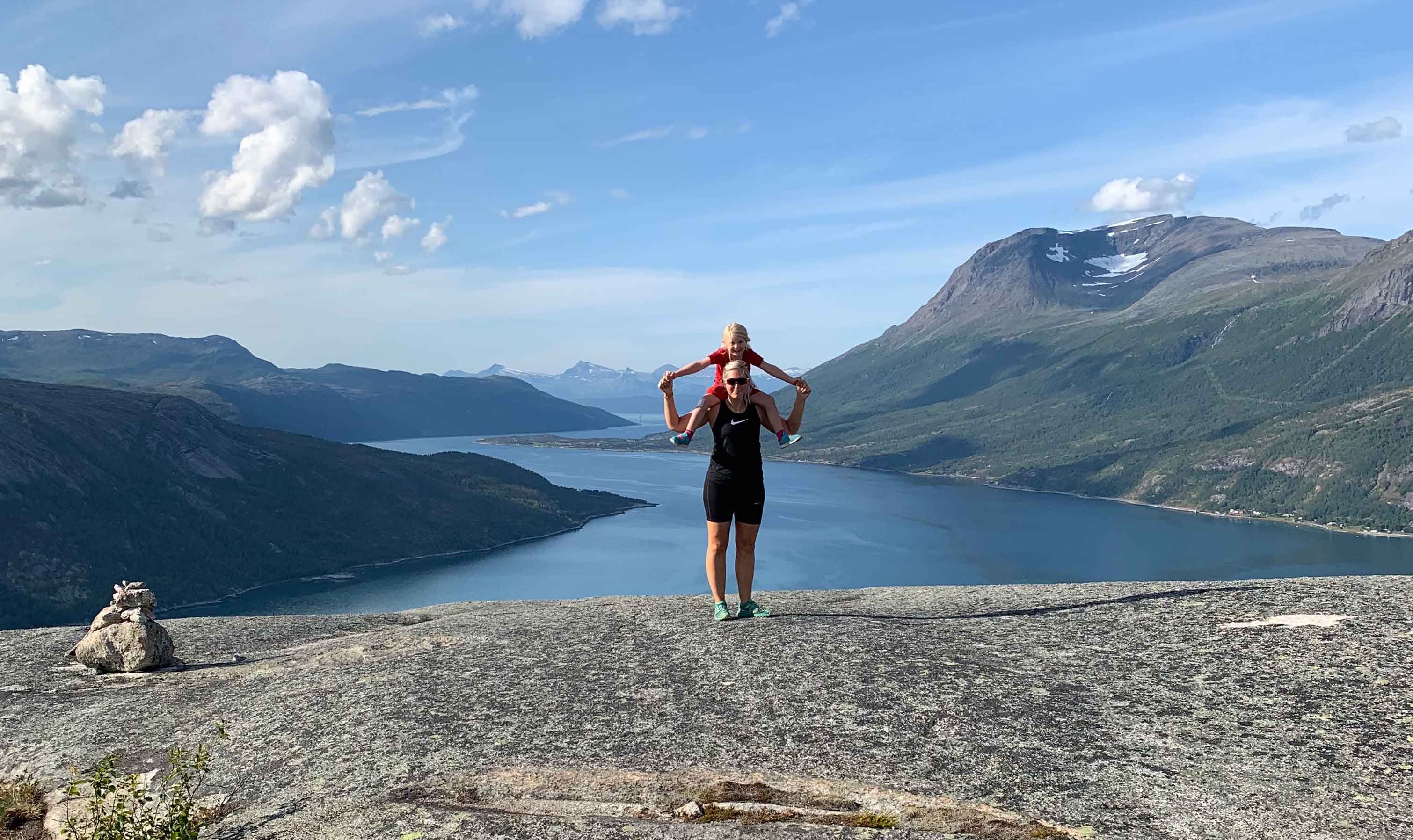
Photo: Stine Holt