


The Nordland Trekking Trail
The Nordland trekking trail is a 650 km long marked hiking route along the border areas between Norway and Sweden, through Nordland county in the middle of Norway. It is split into 8 sections made up of 43 stages with accommodation options between each stage. The trail has several access points, making it possible to walk one or more stages at a time. The route passes through three national parks, Laponia world heritage area, 13 Sami villages, and through a number of nature reserves.
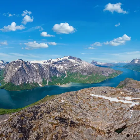
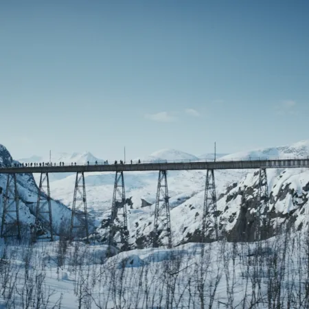
Scenic outlook toward the glacier atop Storsteinsfjellet, 1893 m.a.s.l.
Zdeno Dvorak
Through the Narvik Mountains
The journey through the Narvik mountains along the Nordland trekking trail spans roughly 94.9 kilometers and showcases the highest elevations along the entire route. This segment primarily navigates high mountain terrain, positioned between 700 and 1000 m.a.s.l. Remarkably, two cabins are nestled at an impressive altitude of 1000 m.a.s.l. offering a unique experience in such elevated surroundings.
This section of the epic trail reaches its altitude peak at 1226 m.a.s.l. marking the highest point along the entire route. The initial leg of the journey leads travelers through valleys, gradually descending to Katterat before commencing the ascent into the breathtaking high mountain terrain.
Hiking description
To reach the starting point of this section at Bjørnfjell, you can take the train from Narvik or drive on E10 from Narvik or Kiruna. This section follows the Rallarveien (Navvies' Road), marked on the south side of Bjørnfjell station. Rallarveien traverses easy terrain with a gravel surface. After approximately four kilometers, you'll arrive at Søsterbekk. Take the trail to the right if you want to make a detour up to the small station building at Søsterbekk halt. Here, the track splits into two, with the older part crossing the high Norddalsbrua, which you will pass along the Rallarveien. The bridge was constructed following a demand from the Norwegian defense authorities, and it was intended to be blown up if Russia invaded Northern Norway. Following Rallarveien further may be a bit challenging. Now you must navigate through a steep and landslide-prone section, but in return, you'll have a spectacular view of Norddalen. The Ofotbanen (Ofoten Railway) follows below the road, mostly through tunnels and avalanche shelters. Along the way, you'll also pass a magnificent waterfall. You need to cross the railway line and continue on the steep trail down the mountainside. Shortly after crossing the railway line, you'll reach Vokterboligen.
You can find a map of the section HERE.
Experiences along the way:
- The Ofoten Railway runs alongside the trail.
- Experience the 130-meter-long Norddalsbrua, towering 40 meters above the ground at its highest point.
- Spectacular views of Norddalen.
Follow the Rallarveien (Navvies' Road) down the slope until it crosses over the Hunddalselva on a bridge. Then, turn off from Rallarveien to the left after the bridge. The trail goes uphill along the river and winds its way to Katterat station. If you take the path to the right after the bridge and continue along Rallarveien, you'll end up in Rombaksbotn.
You can see a map of the section HERE.
Experiences along the way:
- Traces of buildings constructed here in the early 1900s.
- Old station buildings at Katterat. They are now used as cabins.
- From Katterat station, you have a view towards Rombaksbotn.
- "Katteratgubben" is a roughly 4-meter-high rock formation located about 50 meters west of the railway station area. Despite its approximately ten-ton weight and balancing on another rock, it has not collapsed despite two tunnel blasting projects nearby.
Follow the construction road from Katterat northwards up Sørdalen/Beatnatvuopmi and further into Hunddalen/Beatnatvággi almost to the end. Just west of Sjufemtenhøgda, the route to Cunojavrihytta diverges. At the end of the road, there is a cabin that is not Hunddalshytta. The trail to Hunddalshytta branches off just before this cabin, and then there is about 900 meters left. Here, there is also a trail junction leading to Cunojavrehytta and Lossihytta.
Alternatively, you can take an unmarked route over Langryggen/Cáicačorru. If you choose this option, you should expect about 1 hour longer. Initially, follow approximately 500 meters along the construction road. Then, turn right at the water reservoir and follow a well-unmarked trail southward beneath Hunddalstoppen, past Karlsenvatnet, Langvatnet, and Krokvatnet on the east side. Continue diagonally down towards the end of Passmyra, onto the construction road, and further on the marked route.
You can see a map of the section HERE.
Experiences along the way:
- Hiking along Hunddalselva.
- Hiking in a valley surrounded by mountains ranging from 1200 to 1400 meters in height.
Follow the trail back approximately 900 meters along Hunddalselva to a trail junction just west of a private cabin and dam. Then, take the trail to the right that crosses over Hunddalselva below the dam. Shortly after the dam, a trail branches off towards Losishytta, but you continue straight ahead. The trail then rounds Nordbergryggen/Sillesčorru and enters the valley, continuing along several small lakes before reaching a resting cabin. You should be prepared to wade through a shallow water area between two of the lakes. About 1 km before the resting cabin, the trail intersects with a path from Katterat via Djevelpasset. The resting cabin, named Oallavagge, has two beds and is operated by the Narvik and surrounding areas tourist association. Follow the trail further on the east side of two larger lakes and up through Oallavággi, passing the east end of Sealggasjávri. Then, the trail goes on the east side of Sealggjohka. About 1 kilometer before Cunojávri, there is a trail junction where the path to the east leads to Unna Allakas, while The Nordland trekking trail continues straight south, crossing the river on a bridge.
You can see a map of the section HERE.
Experiences along the way:
- Hiking along a series of mountain lakes.
- Views over the approximately 1-mile-long lake Sealggasjávri.
- Glimpses of the 1689-meter-high mountain Ristacohkka with its associated glacier.
From Cunojávrihytta, there are two trails heading west. Follow the southernmost trail, which runs closest to the water, and crosses the bridge at the north end of Ákšoluoppal. The trail then continues southwest in flat and gently rolling terrain, south of the small mountain top Báidedievva. The path crosses Gállanjohka and Kalikselva/Cáihnajohka before passing through the valley of Orjjescáihna, past lake 933, and down to Cáihnavaggi. Both rivers need to be forded. If Kalikselva cannot be forded, follow the river downstream for 1.5 km to a bridge south of elevation 728.
You can see a map of the section HERE.
Experiences along the way:
- Fording across rivers.
- Views towards Storsteinfjellet at 1893 meters above sea level.
- Views towards the glacier massif around Storsteinfjellet.
From Cáihnavággihytta, the trail winds southwest between the Skjomenfjellvatnan/Čáihnajávrrit. Initially, the trail goes on the north side of lake 1001 and then on the south side of lake 1090 before ascending the slope to Nordlandsruta's highest point at 1206 meters above sea level. This point is located in a valley between majestic mountain peaks. On the way to this point, two streams/rivers must be forded. The trail then continues through the valley. On the descent, you reach a trail junction. The path to Gautelivatnet/Guovdelisjávri goes to the left, navigating through gently rolling terrain before rounding the nose of Várdahančohkka and proceeding to Gautelsihytta. From the trail junction, it's approximately 5.5 km. Opting to go to Gauteslihytta means a detour of about 7.5 km in total.
You can see a map of the section HERE.
Experiences along the way:
- Hiking at altitudes above 1000 meters.
- Fording across rivers/streams.
- Close encounters with majestic mountains.
From Gauteslihytta, there is a trail heading west that closely follows Gauteslivatnet. After joining a trail from the northeast, the path rounds the northwest end of the lake. The trail crosses several streams/rivers, usually passable without fording. After rounding the northwest end of the lake, the trail joins a construction road, which is followed for about 2.5 km before the trail turns southwest. The construction road continues down to Skjomen. When leaving the construction road, the trail proceeds south of Øvre Kjørrisvatnet/Čoarddajávri and lake 1029. Then, the trail rounds the southwest side of Juovvačorru (1243 meters above sea level) before descending to Skoaddejávre.
You can see a map of the section HERE.
Experiences along the way:
- Hiking in an alpine mountain landscape.
- Close encounters with the regulated Gauteslivatnet. The lake is approximately 14 km long and about 3 km wide.
From Skoaddejávre, the trail heads northwest, running approximately parallel to the national border and descending until it intersects with the gravel road about 2 km south of Iptojávri. From here, follow the gravel road for 13 km to Sitashytta. Shortly after reaching the gravel road, it turns south and enters Sweden, rounding Coadgecorru (1054 meters above sea level) before returning to Norway at the southern end of Tjårdavatnet/Coadgejávri. Afterward, it swings back into Sweden, reaching the northwest end of the enormous border lake, Sijdasjávrre. About 1 km before the cabin, the gravel road enters Norway again. The final part of the gravel road is a toll road.
You can see a map of the section HERE.
Experiences along the way:
- A hike in borderland.
- Close encounters with the 73 km² regulated lake, Sijdasjávrre.
- Seven border cairns located in close proximity to the trail.
An image of the cozy Cunojávri cabins nestled amidst pristine wilderness.
Zdeno Dvorak
Book cabins
You'll book one cabin at a time, ensuring completion of your booking at the first cabin before moving to the next. Some cabins also reserve beds for drop-in guests. Visit www.hyttebestilling.dnt.no to check cabin availability and make reservations. For cabins not available for booking on the site, find details on their individual websites at www.ut.no
Most cabins without hosts are secured using DNT's standard key. It's advisable to carry this small key in your bag whenever you venture out. Members can acquire the key by depositing NOK 100 at the Tourist Information Centre in Narvik.
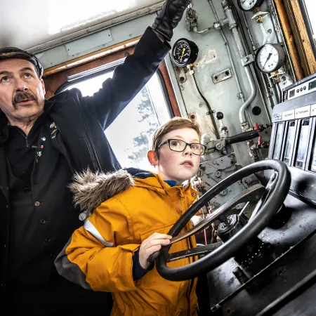
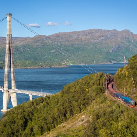
Train departures from Narvik Station, symbolizing the start of an adventurous hike in the Narvik Mountains.
Michael Ulriksen
Access points
Accessing the various stages scattered across the rugged terrain of the Narvik mountains offers a multitude of options, ensuring convenience and flexibility for travelers.
Whether by train, car, ferry, or boat, there are diverse means to embark on your journey into this captivating landscape.
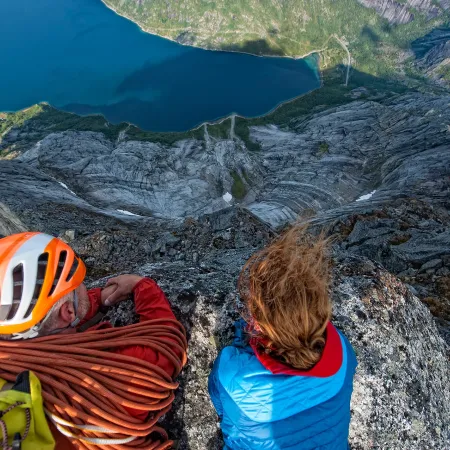
Brace yourself for a test of strength and determination amidst awe-inspiring natural landscapes.
Zdeno Dvorak
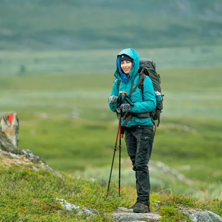
Preparing for the challenges
The Narvik mountains feature 94.9 kilometers of marked hiking trails weaving through stunning natural and mountainous landscapes. Whether you prefer tackling segments, sections, or the entire stretch in one expedition, the choice is yours.
Nevertheless, it's essential to note that these trails are challenging and extensive, requiring excellent physical fitness and familiarity with rugged mountain terrain.