


The summit is a beautiful sight for hikers in the area and is a very popular peak that is climbed by hundreds of people each year. The top looks mildly demanding in its best profile, but despite this, it is a relatively simple top to climb, and has for several years been on the “Ten on top hiking trails” in the Narvik region.
The most common starting point for a trip to Tøttatoppen is at the mini-power plant where the starting point of Tøttadalen Valley is located. This is one of the most visited hiking areas in Narvik for families and hiking tourist at all levels. Follow the E6 route to Narvik and take off towards Narvikfjellet Alpine resort, and at the bottom of the alpine slopes turn left towards the mini-power plant where the starting point for the tour is.
- Marked trail
- Suits everyone, however some parts of the trail can be quite steep
- Great view of Stetind, the Lofoten walls, mountain ranges and fjords
- Be cautious near the top
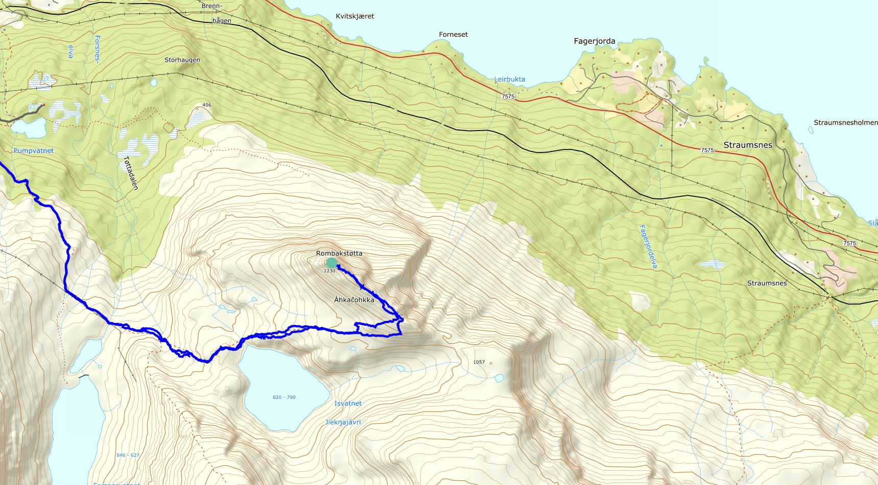
Please note that the maps are intended to give the starting point and approximate direction for the trip. They are not intended for precise positioning. You always have to make your own judgments when you are on a trip in the mountains based on what you see and think.
Practical Information
Distance from the town of Narvik: about an hour south of Narvik on the E6.
Access: Drive E6 to Skjellesvikskaret and park in the upper parking lot at the left side of the road as you head south.
Drive E6 to Skjellesvikskaret and park in the upper parking lot at the left side of the road as you head south.
The trail starts on the other side of the road where you park, as you follow the markings along the back towards Kjerna. The path is somewhat broken up and has some parallel runs. You have to follow the line, up against the little slope at the bottom of Kjerna. Then you follow the left side of the slope before you turn right at the top of the slope. After that, you follow the direction towards the small water which will find place in front of you, before turning left, up to the top at a small headstone which will meet you about 200 meters before the water. A few hundred meters further up the path take you toward a large rock and turns up towards the "Pulpit".
Medium – Blue grading
Suitable for:
Beginners and walkers of average fitness. For hikers with basic hiking and outdoor skills.
Type of path and terrain:
Similar to green trails, but can have more challenging sections. Can be rocky but no demanding scree. No streams to be crossed.
Altitude metres, maximum trip length:
Elevation difference: less than 600 metres. Max length: 10 km.
Degree of elevation and exposure:
Most ascents are moderate, but can include some steep slopes. Certain sections can be considered precipitous for some.