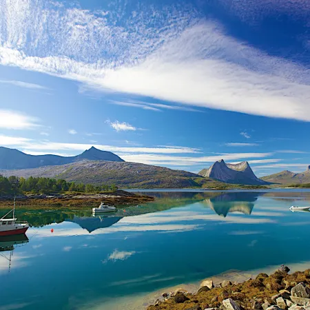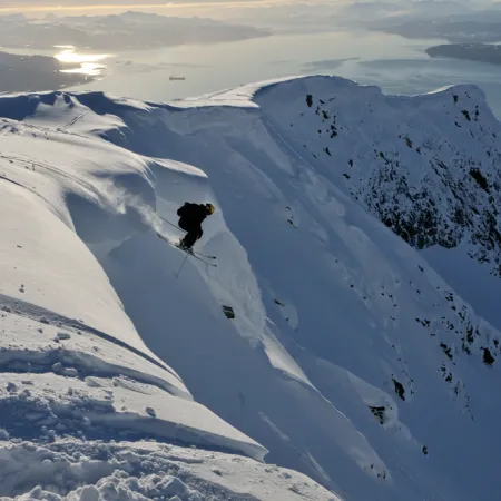


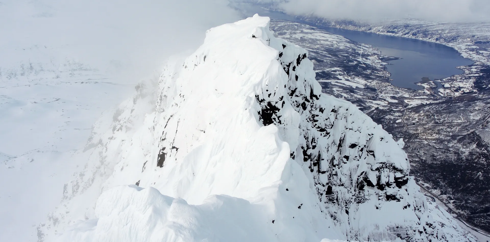
Soutwest of the city of Narvik there is an almost 4 kilometer long, continous rock wall. The northernmost summit along this wall, is called Rånkeipen and is with its 1200 meters of elevation also the highest in this massif. With steep mountain sides and cliffs running down towards the west, east and south from the summit, Rånkeipen is a stunning mountain. But to the north, the slopes that runs down from the summit is fairly gentle in steepness and becomes quite wide a little bit further down and offers spectacular skiing in rolling terrain that makes it feel like you are skiing directly into the ocean.
The normal route to the summit is the same as the summer path and starts from the E6, where you cross over a field to reach a dirt road that runs through the forrest on the northside of the river Rånbogelva. From here you follow this road to the treeline, where you cross over the river and continues on to the south of the small hill named Malmhaugen. Here you will pass some short sections that are over 30 degrees steep. From Malmhaugen one continues on south towards Råntindaksla, a point at about 860 meters elevation on the summit ridge. From Råntindaksla the route goes eastwards. There are steep cliffs south of the ridge and care should be taken here when putting up the track towards the summit of Rånkeipen. The last 60 meters or so are quite steep and it might be best to take of the skis and climb the last section towards the summit on foot. The summit area is quite narrow, with steep sides and cliffs the the west, east and south and one shold be careful when approaching the edge here, especially in poor visibility.
From the summit you can enjoy the spectacular view towards the surrounding fjords and mountains and towards the glacier of Frostisen, which with its 25 square kilometer is the 12th largest glacier in Norway.
Aside from a short section on the summit ridge just after reaching Råntindkaksla and the last climb just before the summit, one will not have to pass through terrain above 30 degrees steep, but when crossing over from Malmhaugen towards Råntindaksla you will be within the run out zone of potential avalanches from the big slopes to the south and east.
When going down, the normal route isto follow down the same way as going up, but it is possible to choose more challenging alternatives to the north of the summit and through the forrest on the soutshide of Rånbogelva. It is important to be aware that these alternatives goes through much more challenging and exposed terrain in regards to avalanches.
Parking: Along the E6 at Rånbogen
Driving distance and time from the city of Narvik: Approximately 30 minutes and 30 km
Duration: Approximately 5 hours
Elevation: 1150 meters