


The Navvy Road
Renowned as one of Norway's most picturesque trails, the navvy road offers a well-marked path that traces a historical route. Originally constructed to transport crews and materials through the remote Norwegian-Swedish mountain regions for building the Ofoten Line, this path holds immense historical significance.
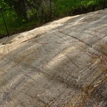
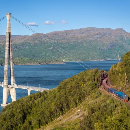
An aerial shot shows the navvy road descending from the mountains to the fjord.
Sverre Hjørnevik
In the footsteps on the Navvies
It begins at the lofty mountain plateau of Riksgränsen (520 masl), guiding hikers through lush, steep valleys, ultimately descending to the stunning Rombaken fjord. Covering a distance of 16.2 km from the Swedish border to Rombaksbotn, completing this hike means you've crossed Norway on foot!
The beauty of the Navvy Road lies in its versatility, it accommodates various hiking lengths and is suitable for most individuals, provided they have sturdy footwear. So, lace up your hiking boots and prepare for an unforgettable journey through history and nature's wonders.
The guided tour, complete with historical narration, is also an option for groups upon request.
Enjoy the ultimate convenience by bundling train and boat transport, ensuring a seamless and unforgettable journey. Book now for the best experience!
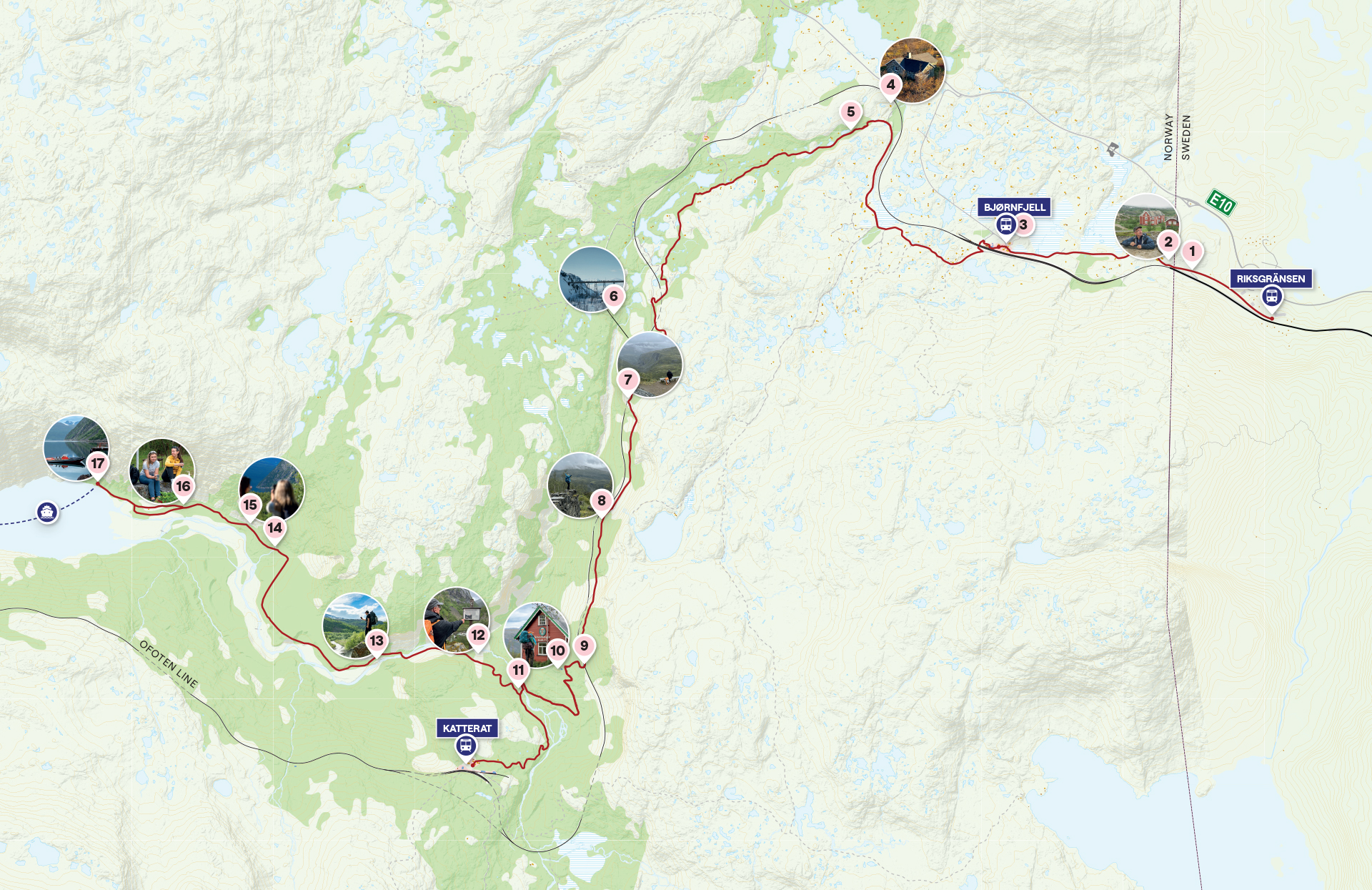
Hiking routes along the Navvy Road
You can explore segments of the Navvy road through three varying hiking distances.
6.5km Katterat - Rombaksbotn
Narvik to Katterat by train, hike 6.5 km to Rombaksbotn Quay, return to Narvik by boat and bus.
Transport to Katterat by train
D: 10:30 - Narvik Station
A: 11:05 - Katterat Station
Transport from Rombaksbotn by boat
D: 18:00 Rombaksbotn Quay
A: 19:30 Narvik Station
11km Bjørnfjell - Katterat
Narvik to Bjørnfjell by train, hike 11.0 km to Katterat, return to Narvik by train.
Transport to Bjørnfjell by train
D: 10:30 - Narvik Station
A: 11:20 - Bjørnfjell Station
Transport from Katterat by train
D: 18:01 Katterat Station
A: 18:38 Narvik Station
16.2km Riksgrensen - Rombaksbotn
Narvik to Riksgrensen by train, hike 16.2 km to Rombaksbotn Quay, return to Narvik by boat and bus.
Transport to Bjørnfjell by train
D: 10:30 - Narvik Station
A: 11:25 - Riksgrensen Station
Transport from Rombaksbotn by boat
D: 18:00 Rombaksbotn Quay
A: 19:30 Narvik Station
Proud navvies pose by completed tracks, beaming with accomplishment.
Museum Nord
The Navvy Legacy
From past to present their legacy shines bright The legacy of the navvies persists in the enduring tale of the Ofoten Line's construction, a feat largely achieved through manual labor. The navvies, were itinerant laborers who played a pivotal role in shaping the railway. The unforgiving landscape and weather along the Ofoten line made it an incredibly challenging endeavor, demanding resilience from those involved. Enduring bitter cold, perpetual darkness, and relentless winter storms, these workers found solidarity through their shared hardships, fostering a culture rich with camaraderie and marked by the iconic Navvies hat. Their vibrant legacy lives on robustly to this day.
Narvik's Winter Festival annually celebrates these heroes with a vibrant ten-day event filled with concerts, dance, theater, and art. Attendees, young and old, don historical attire, transporting the city back to the late 19th century.
Through the lens of history, the lost city of Rombaksbotn emerges from the shadows,
Museum Nord
The lost city of Rombaksbotn
As your journey along the navvy road concludes, you arrive at the abandoned town of Rombaksbotn nestled by the fjord. While exploring its numerous ruins, you're transported 120 years back in time to the vibrant construction hub of the Ofoten Line. Through an animated video, Rombaksbotn springs to life, revealing a bustling community of 700 diligent residents flourishing during the late 19th-century construction boom.
Points of Interest
The historical route features numerous viewpoints and historical sights that are well worth a stop on your journey to Rombaksbotn.
This historic roundhouse at Niehku used to be a hub for steam-era trains swapping between Norway and Sweden. It handled essential tasks like cleaning, and restocking coal and water.
Bunkers with connections to both World Wars, offering a glimpse into historical events.
Built back in 1923 during the electrification of the Ofoten Line, this station sits at an impressive height of 517 meters above sea level, making it the highest in the area.
A significant site during WW2, serving as the headquarters for German General Eduard Dietl during the battle for Narvik.
Explore bunkers on the mountainside used as shelter for soldiers. Remember to bring a flashlight and waterproof shoes for a safe visit inside.
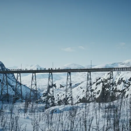
An old Pendulum-pillar bridge constructed in 1902 and featured prominently in the film "The Battle for Narvik."
A fantastic spot offering views of the untamed Norddalen and passing trains along the railway.
This station facilitated the transfer between large and small cable cars, providing an interesting sight for visitors.
Safety first! Watch out for passing trains when crossing the tracks.
An old worker's house available for rent, equipped with outhouse facilities.
A former administration site during the construction of the Ofoten Line, featuring houses, information signs, fire pits, and outhouse toilets.
Once a significant power station, supplying energy to the drilling machines in the longest tunnels of Northern Norway.
A picturesque spot near a waterfall with benches and a fire pit. Mind the slippery rocks for safety.
Enjoy a beautiful view of the Sister Streams cascading down the mountain.
A high vantage point offering panoramic views of the surrounding area.
A junction where you can explore the old main street or visit the ruins of an old farmstead. Shelters and outhouse toilets are available in the area.
Access boat transportation back to the floating dock in Sildvik and continue the journey to Narvik.